

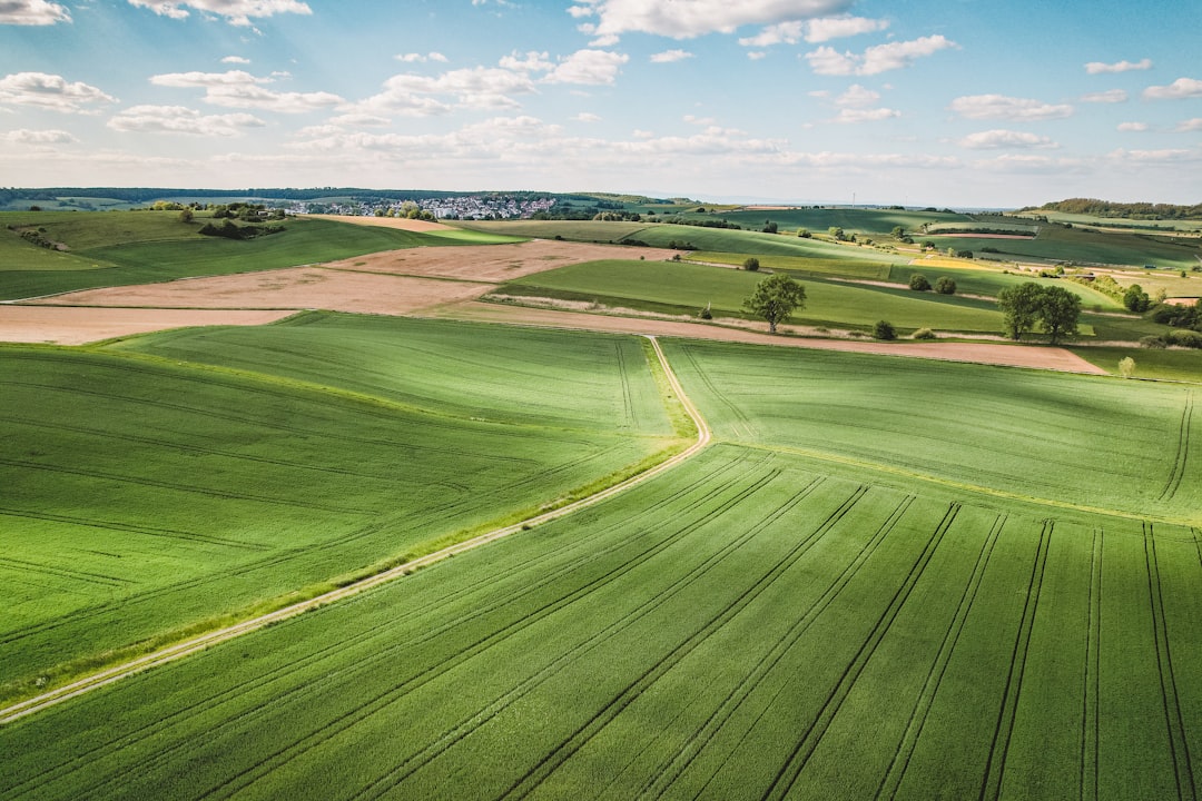
If you’ve spent any time around farming, building sites, or fire stations in the past year, you’ve probably seen them: small aircraft hovering overhead, collecting data faster and cheaper than anything humans could do manually. The drone technology agriculture infrastructure market is expected to grow from USD 5.78 billion in 2026 to approximately USD 23.1 billion by 2032, a staggering expansion driven by real-world wins that go way beyond the hype. But the story isn’t just about agriculture anymore. Drones are fundamentally reshaping how we manage farm fields, inspect critical infrastructure, and respond to life-threatening emergencies. This isn’t incremental change. It’s transformation.
The catch? Most people still think of drones as toys or surveillance equipment. They miss the practical, unglamorous work that’s already happening. On farms in North America and beyond, drone technology agriculture infrastructure is catching disease before it spreads. On bridges and power lines, drones are finding cracks before they become catastrophes. In emergency rooms and disaster zones, drones are racing against time to save lives. You don’t hear about it often because it just works.
Drone Technology Agriculture Infrastructure is Mainstreaming Precision Farming
Here’s what changed in farming: precision stopped being a luxury. The agriculture drones market will grow from $3.39 billion in 2025 to $4.41 billion in 2026 at a compound annual growth rate of 29.8%. That’s not typical business growth. That’s a sector that finally got real proof that drones actually save money.
Start with the numbers. Farms may decrease their water use for spraying by up to 90% by using drones for precise spraying and monitoring, and this targeted use of resources leads to yields that are 5–10% higher in different crops. Those aren’t marketing promises. That’s the difference between profitable and bankrupt for a mid-sized operation during a drought.
A lot of farmers I’ve talked to mention the same turning point: when they realized manual scouting was obsolete. Walking your fields takes days. Your crops change in hours. Crop Monitoring & Surveillance accounted for nearly 55% of the global market share, which tells you where farmers actually see the value. They’re not buying drones for the novelty. They’re buying them because competitors who wait end up behind.
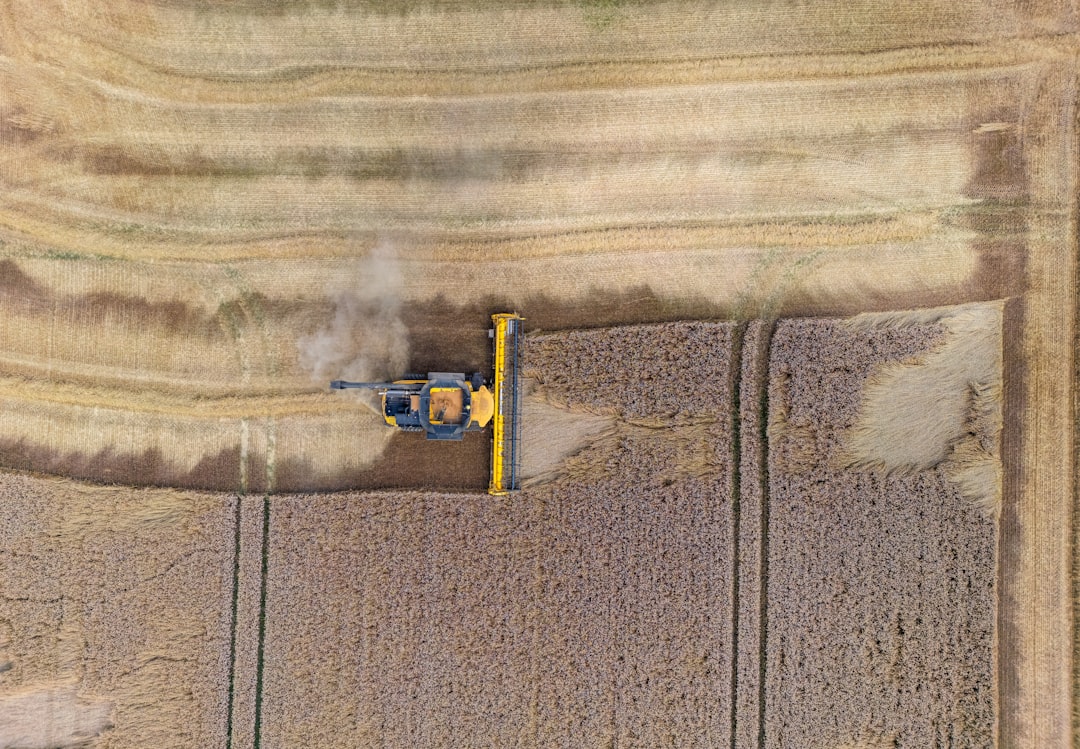
The real winner here isn’t speed, though. It’s the data. Modern drones carry multispectral cameras that see what your eyes can’t. Early disease detection. Soil moisture patterns. Pest stress before symptoms show. All of that translates to intervention before loss. You’re not reacting. You’re preventing. That’s the shift.
Drone Technology Agriculture Infrastructure Transforming How We Inspect Infrastructure
Bridge maintenance used to mean closing lanes, sending inspectors up with rope or lifts, and hoping they didn’t miss anything. Now? Leading companies include DJI, XAG Co., Ltd., DroneDeploy, AgEagle Aerial Systems Inc., and PrecisionHawk, among others in the broader drone space, and many are pivoting into infrastructure. The economics are brutal for the old way.
Drone technology agriculture infrastructure companies have started offering specialized infrastructure inspection services. Power lines, tower inspections, bridge undersides—places where humans either can’t easily go or shouldn’t go—now get mapped by aircraft with centimeter-level accuracy. A tower inspection that used to take a climbing crew two days and cost thousands? Drones do it in hours for a fraction of the price. No one gets hurt. No missed details buried in field notes.
The real shift is preventive maintenance at scale. You can inspect your entire network on a schedule instead of waiting for failure. For utilities managing thousands of miles of critical infrastructure, that changes the game fundamentally. Risk goes down. Downtime shrinks. Costs follow.
What makes this actually work is the software integration. Raw drone footage is useless without analysis. Specialized AI now processes thousands of images to flag deterioration, corrosion, structural shifts—things that would take human eyes weeks to catalog. You get actionable reports, not raw data dumps.
How Drone Technology Agriculture Infrastructure Powers Emergency Response
This is where drones stop being about efficiency and start being about life-and-death.
Lakewood introduced its cutting-edge drone unit in 2025, meeting with immediate tactical success. In the first six months, drones arrived on scene ahead of ground units 80% of the time. That’s not a marginal improvement. That’s first responders who literally have the situation on camera before anyone in uniform arrives.
The traditional model for emergency response is broken in a specific way: by the time a human responder gets eyes on a scene, seconds have already shaped the outcome. A car accident that’s minor or major. A medical emergency where every minute is brain damage. A search area that stretches for miles.
Drone technology agriculture infrastructure also applies to emergency response contexts. Consider medical delivery: Drones can send out overdose-reversal and allergy medication as well as automated external defibrillators (AEDs) to remote locations or traffic-congested areas. Sweden ran the numbers. In a four-month trial of 53 suspected OHCA cases, emergency response drones were eligible for dispatch in 14 instances. They successfully delivered an AED in 11 of 12 deployments.
That’s not experimental anymore. That’s real.
Search and rescue is another proving ground. Drones cover more ground than traditional search parties, especially when they can fly at 400 feet instead of 200 feet, saving a lot of time in rescue missions. When equipped with thermal imaging cameras, they can detect heat signatures, allowing teams to find lost or injured individuals faster than they would with traditional methods like rescue dogs.
I once watched a demo where a thermal-equipped drone found a missing hiker in dense forest at dusk—someone who would’ve required at least a full night of ground searching. The drone did it in five minutes. The hiker made it out. That’s not a statistic. That’s a life.
Why Large-Scale Adoption is Finally Happening
Three things had to fall into place, and they all did around 2025–2026.
First: affordability. Growing adoption of precision agriculture practices, early availability of affordable commercial-grade drone sensors, initial government subsidies and pilot programs supporting farm automation created a real entry point for small and mid-sized operations. You don’t need venture capital anymore. You don’t even need massive capital. A commercial drone setup starts under $10,000. That’s a tractor repair, not a business bankruptcy.
Second: regulation finally made sense. Pilots Programs started working. Rules that actually allowed commercial operation without requiring a PhD in federal compliance. Airspace sharing became more predictable. Insurance models settled down.
Third—and this matters most—the data became undeniable. The market expansion is primarily driven by the rapid adoption of precision agriculture technologies, increasing demand for real-time crop monitoring, rising pressure to improve agricultural productivity, and the integration of advanced technologies such as artificial intelligence, multispectral imaging, and data analytics platforms in modern farming practices. Word spread. Early adopters who bought drones stopped being outliers and started being the norm.
Challenges that Still Aren’t Solved
Here’s where I tell you the uncomfortable truth: drone technology agriculture infrastructure deployment is still messy in ways people don’t talk about.
Battery life. Yes, technology improved, but a lot of drones still have 20-30 minute flight times. That’s fine for a small field. It’s a problem for 1,000 acres or disaster response across a wide area.
Weather sensitivity. Drones in heavy rain? High wind? No. They’re fair-weather tools. That matters when you need them most.
Regulatory uncertainty still exists in some regions. The DRONE Act of 2025 helped clarify things federally, but state and local rules vary wildly. With the introduction of the Directing Resources for Officers Navigating Emergencies (DRONE) Act of 2025, it’s clear that more legislators and first responders recognize the importance of emergency response drones.
And then there’s the data ownership question—still unresolved in a lot of cases. Who owns the thermal imagery of your neighbor’s property? What about the agricultural data captured over your fields? Legally, it’s murky. Practically, it’s creating friction.
Frequently Asked Questions
What Exactly is Drone Technology Agriculture Infrastructure?
Drone technology agriculture infrastructure refers to the use of unmanned aerial vehicles (UAVs) equipped with cameras, sensors, and specialized payloads to monitor crop health, inspect physical structures like bridges and power lines, and support emergency response operations. These drones collect real-time data, process it using AI, and provide actionable intelligence for decision-making across farming, infrastructure management, and crisis response.
How Much Can Drone Technology Agriculture Infrastructure Actually Save Farmers on Water?
Farms may decrease their water use for spraying by up to 90% by using drones for precise spraying and monitoring. Savings depend on your operation size, crop type, and current irrigation practices. Some smaller operations see 40-50% reductions. Large-scale precision farms often hit closer to 80-90%. The real payoff comes from combining water savings with yield improvements.
Can Drone Technology Agriculture Infrastructure Actually Arrive Before an Ambulance in Emergencies?
Yes, in specific scenarios. In a four-month trial of 53 suspected OHCA cases, emergency response drones were eligible for dispatch in 14 instances. They successfully delivered an AED in 11 of 12 deployments. In 64% of these cases, the UAV arrived before the ambulance. Response time advantage is real, especially in rural areas or traffic-congested cities where ground dispatch takes longer.
Is Drone Technology Agriculture Infrastructure Still Too Expensive for Small Farms?
Not anymore. Commercial drone setups start under $10,000, and many farmers access drones through service providers who charge per-flight or per-acre rates. Some states offer subsidies for precision agriculture tech. That said, initial investment can still be a barrier for subsistence-level operations.
What’s the Biggest Regulatory Problem with Drone Technology Agriculture Infrastructure Right Now?
The biggest issue isn’t federal—it’s regional fragmentation. The FAA cleared commercial operation, but state and local rules vary widely. Airspace usage, line-of-sight requirements, and data privacy rules differ by jurisdiction. It’s workable but adds complexity, especially for operations spanning multiple states.
The Takeaway: This is Real, Not Hype
Drone technology agriculture infrastructure isn’t coming. It’s here. The Global Agricultural Drones Market is projected to grow at a CAGR of around 21.89% during 2026–2032. But growth rates are just numbers.
What matters is this: drones are moving from “interesting experiments” to “how we actually do this work now.” Farmers who don’t use them are falling behind on yield and efficiency. Infrastructure managers who skip drone inspection end up with maintenance crises instead of maintenance plans. Emergency responders who don’t deploy them on scene are making the outcome worse by being slower.
The technology isn’t magic. It’s not perfect. Batteries die. Weather limits operations. Regulations create friction. But when you need precision farming at scale, infrastructure monitored before it fails, or an AED on scene in minutes, drones do what nothing else can do better or cheaper.
If you work in agriculture, infrastructure, or emergency management and haven’t seriously looked at drone deployment yet, you’re not being cautious. You’re falling behind. The question isn’t whether this becomes standard. It’s how long you wait before making it yours.
